NWS reports 5 tornadoes in southern Indiana, 1 in Ky. from Sunday storms
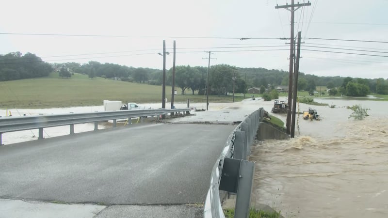
LOUISVILLE, Ky. (WAVE) - The Louisville area was met was severe thunderstorms Sunday morning, leaving several without power.
As of Monday afternoon, the National Weather Service confirmed five EF-1 tornadoes in southern Indiana and one tornado in Kentucky as a result of the storms.
A severe thunderstorm warning was issued by the National Weather Service around 9 a.m. on Sunday.
(Story continues below)
Severe Thunderstorm Warning including Louisville KY, Jeffersonville IN and New Albany IN until 9:15 AM EDT pic.twitter.com/0nFHjq04RJ
— NWS Louisville (@NWSLouisville) May 7, 2023
The National Weather Service later confirmed an EF-1 tornado hit the north side of New Albany off Grant Line Road near IU Southeast campus.
Winds were estimated to be around 100 mph.
(Story continues below)
NWS says EF-1 tornado struck the north side of New Albany off Grant Line Rd this morning with wind gusts around 100 mph.
— Brian Goode ❄️ (@BGoodeWAVE3) May 7, 2023
A NWS storm survey this afternoon found evidence an EF-1 tornado impacted portions of the Indiana University Southeast campus in New Albany. Estimated peak winds were 105 mph. #INwx pic.twitter.com/3JcSCLJo2e
— NWS Louisville (@NWSLouisville) May 7, 2023
Another EF-1 tornado was confirmed in southern Floyd County, Indiana at The Sporting Club and at the Farm.
Winds were estimated to be around 95 mph.
(Story continues below)
NWS Louisville has found damage from at least an EF-1 tornado in southern Floyd County, IN at The Sporting Club at the Farm.
— Jessica Dobson (@JessicaDobsonWX) May 7, 2023
So far, peak winds are estimated at around 95 mph. The survey is still ongoing so more updates are to come. @wave3news
Viewers from the affected areas sent in photos and videos of the storm as it passed through.
(Story continues below)
#TORNADO CAUGHT ON CAMERA
— WAVE Weather (@WAVE3Weather) May 8, 2023
Brad McQueary sent us this home security video of what appears to be the 100 MPH EF-1 tornado hat ripped through SW #Louisville Sunday morning, moving in from Floyd Co, IN.
Brad's location in Shively matches up perfectly with @NWSLouisville's survey. pic.twitter.com/4nFkNpHAF3
On Monday, NWS Louisville determined an EF-1 tornado hit near Hamby Road in Georgetown, Indiana. The tornado was a short track, with wind speeds estimated at around 90 mph.
(Story continues below)
A fourth tornado was confirmed in Georgetown, Indiana. NWS said the tornado was an EF-0 with wind speeds estimated around 80 mph in the Brookwood subdivision.
(Story continues below)
NWS has also found evidence of EF-1 #tornado damage near Hamby Rd in Georgetown, IN. Short track, 90 MPH tornado.#WAVEWeather
— WAVE Weather (@WAVE3Weather) May 8, 2023
A fifth tornado was confirmed Monday afternoon in Shelby County, Kentucky. NWS said the tornado was an EF-0 with 75 mph winds.
The tornado passed through between Valero and Black and Decker buildings near Shelbyville.
On Tuesday, NWS confirmed a sixth tornado from Sunday’s storms. An EF-1 tornado was reported in southern Floyd County, about three miles south of Edwardsville, Indiana.
Winds were estimated around 90 mph.
(Story continues below)
BREAKING: A 6th #tornado from Sunday morning's storms has been confirmed in southern Floyd Co, IN, an EF-1 with 90 MPH winds. (Shelby Co, KY tornado not shown on map) #WAVEWeather app: https://t.co/0wPeanb1m7 pic.twitter.com/kNiphC2UhF
— WAVE Weather (@WAVE3Weather) May 9, 2023
To view LG&E’s power outage map, click or tap here.
Copyright 2023 WAVE. All rights reserved.