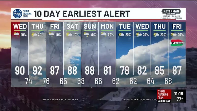
FORECAST | Hot and humid mid-week
WEATHER HEADLINES
- NEXT 12: Hot & humid with highs near 90° and a heat index near 100°
- SHORT TERM: Heat and humidity linger on Thursday
- LONG TERM: Scattered storms possible early Thursday and Friday mornings
FORECAST
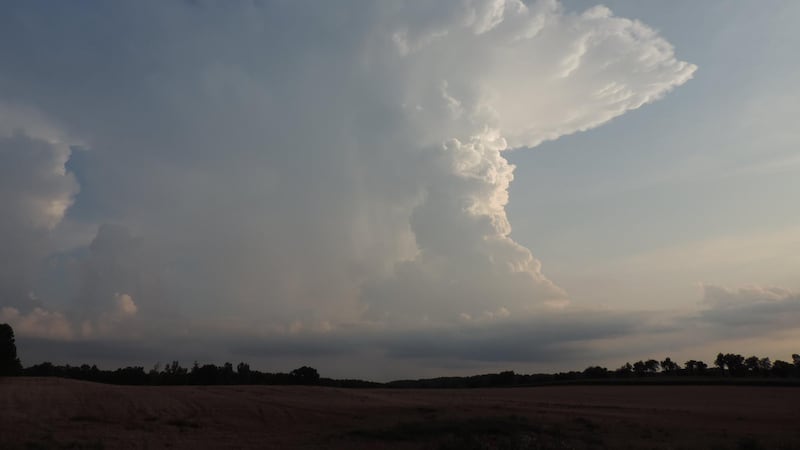
LOUISVILLE, Ky. (WAVE) - Isolated showers and thunderstorms remain possible this morning; some can produce locally heavy rainfall.
By the afternoon, we’ll see a mix of sun and clouds with highs near 90° and a heat index near 100°.
After a quiet evening with partly cloudy skies, scattered showers and thunderstorms move into the region by early Thursday morning.
It will be warm and muggy night; expect lows in the 60s and 70s.
Any early morning showers and storms fade quickly after sunrise. The rest of our Thursday looks humid and hot. Highs jump into the upper 80s and low 90s tomorrow afternoon; heat index values can approach 100°.
An isolated downpour can’t be ruled out. An approaching cold front brings scattered showers and thunderstorms back into the area Thursday night. Lows slide into the 60s and low 70s.
Rain chances linger into Friday morning, before drier weather returns Friday afternoon.
Copyright 2026 WAVE. All rights reserved.